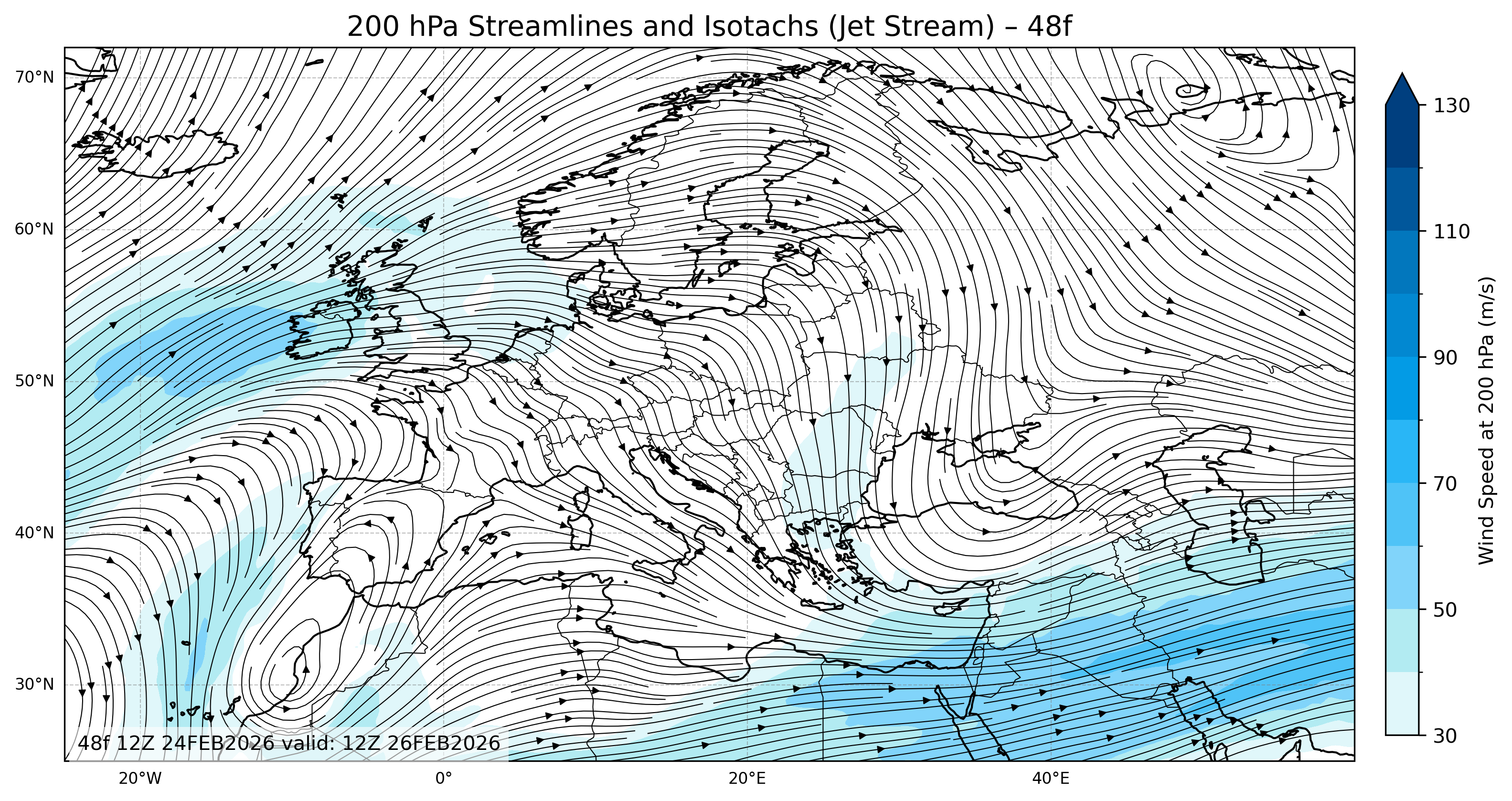
The Euro 200mb streamlines and isotachs (jet stream) 48f map displays the upper-level wind field across Europe at approximately 200 hPa, or about 12 kilometers above sea level. This is the region where the jet stream is strongest and plays a crucial role in shaping large-scale weather systems.
Euro 200mb streamlines and isotachs 48f: What the Map Shows
This map combines two essential atmospheric elements:
- Streamlines: Represent the direction and curvature of the wind flow. When streamlines are close together, it indicates stronger winds and tighter gradients in the upper atmosphere.
- Isotachs: Contour lines connecting points of equal wind speed. These are color-filled bands that highlight jet streaks—zones of maximum jet stream velocity.
Together, streamlines and isotachs visualize how air moves and accelerates within the jet stream.
Understanding “48f”
The number 48f refers to a 48-hour forecast (48 hours into the future).
- “00” maps show the initial or current analysis.
- “24f” maps show the next 24 hours.
- “48f” maps show the projected jet stream pattern 48 hours ahead.
This allows forecasters and weather enthusiasts to track how the jet stream shifts and evolves over two days.
Using the 200mb Streamlines and Isotachs Map
The Euro 200mb streamlines and isotachs (jet stream) 48f map is widely used to:
- Identify jet cores and jet streak entrances/exits.
- Detect potential areas of turbulence for aviation.
- Study the relationship between upper-level divergence and surface weather systems.
- Monitor the overall zonal (west-east) and meridional (north-south) flow patterns over Europe.
Reading the Color Scale
- Lighter blue shades indicate moderate wind speeds.
- Darker blue or purple areas represent stronger winds within the jet core (often exceeding 100 m/s).
- The legend beside the map shows the wind speed range at the 200 hPa level.
These colors help users easily determine where the atmosphere’s most powerful winds are located.
Applications
The Euro 200mb streamlines and isotachs (jet stream) 48f chart is an essential resource for:
- Meteorologists analyzing mid-latitude dynamics,
- Aviation experts monitoring flight-level winds and turbulence,
- Researchers studying climate and atmospheric circulation, and
- Weather watchers following jet stream shifts over Europe.
Click for 200 hPa streamlines and isotachs (jet stream) 72f.